
Drone mapping & surveying in Calgary
Accurate orthomosaics, surfaces, volumes and AutoCAD linework for engineers, surveyors, developers and municipalities.
Drone mapping and survey deliverables
A drone captures a full site in a fraction of the time a ground crew needs, then we turn it into mapping products your team can use in CAD and GIS.
- Orthomosaic maps
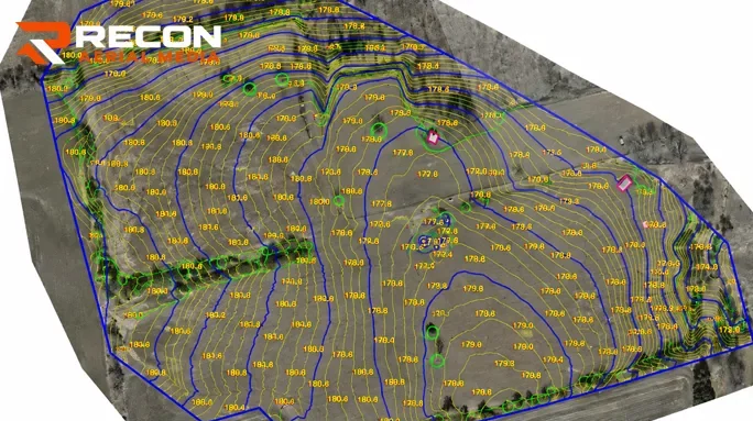
- Topographic surveys and contours
- Digital surface and terrain models
- Stockpile volume reports
- Point clouds and 3D models
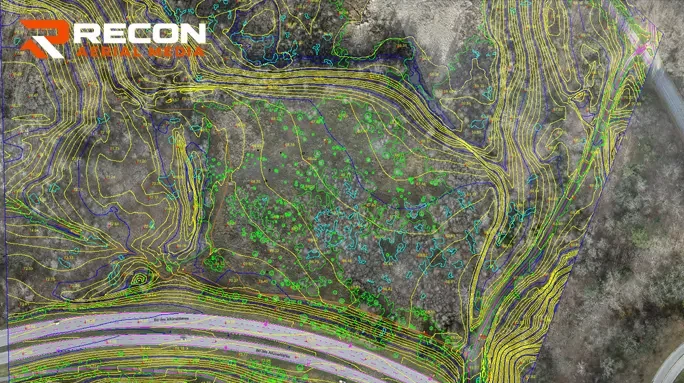
- AutoCAD linework from drone data
- Cut and fill comparisons
- Site plans for development
Drone data processing: we'll process yours
Surveyors and drone operators can hand off post-processing to us and stay focused on fieldwork and clients.
- Send imagery plus GCP, RTK or PPK data
- We process the data and check its quality
- You receive exports and CAD linework
Who uses drone mapping?
- Land developers and planners
- Civil engineers and surveyors
- Aggregate and gravel operations
- Municipalities and counties
- Environmental consultants
Drone surveys for Calgary-area development
New communities, industrial parks and gravel operations around Calgary change quickly. A drone survey captures an entire site in a single flight, so developers, engineers and aggregate operators can track earthworks, measure stockpiles and plan the next phase from current data.
We deliver in your project's coordinate system, including NAD83(CSRS) UTM and Alberta 3TM, and work with ground control points or RTK/PPK positioning to meet the accuracy your project needs.
Typical drone mapping projects
- Pre-development topographic surveys
- Monthly stockpile volume reports
- Cut and fill tracking during earthworks
- As-built orthomosaics for municipalities
- Base maps for environmental assessments
From first call to final files
Consultation
Tell us about the site, the deliverable you need and your timeline. We send back a fixed quote.
Planning
We check airspace, permits and site safety, plan the flight and coordinate access with your team.
Flight operations
Certified pilots capture the data or footage safely, with minimal disruption to your site.
Deliver
You get processed, ready-to-use files: reports, maps, CAD, photos or edited video.
Drone mapping FAQ
Can you process drone data I've already flown?
Yes. Surveyors, engineers and drone operators can send us their imagery along with GCP, RTK or PPK data. We process it, check quality and deliver the exports and CAD files you need.
What file formats do you deliver?
Typical deliverables include GeoTIFF orthomosaics, point clouds, digital surface and terrain models, contours and AutoCAD DWG linework. Tell us your formats and coordinate system when you request a quote.
How accurate is drone mapping?
Accuracy depends on ground control, RTK/PPK positioning and flight height. We plan these around the accuracy your project needs, and we can provide a ground control accuracy report with the deliverables.
More drone services in Calgary
Drone Inspections
Roofs, facades, flare stacks, towers, bridges and wind turbines, inspected without lifts, scaffolding or shutdowns.
Construction Progress
Scheduled aerial updates from the same viewpoints every visit, for owners, lenders and project teams.
Drone Video
Project highlight videos, construction time-lapses, industrial films and vertical cuts for social media.
Commercial Photography
Aerial, interior and exterior photography of properties, showrooms, offices, retail and new buildings.
Need a site mapped near Calgary?
Tell us what you need. You'll get a fixed quote, usually within one business day.